
Snowfall in Houston: Explore the unprecedented January 2025 snowfall in Houston, its historical context, impacts on daily life, and lessons for future preparedness.
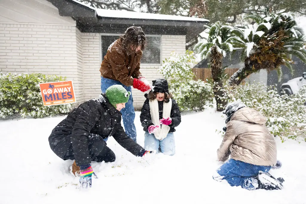
On January 21, 2025, Houston experienced a rare and historic snowfall, marking one of the most significant winter weather events in the city’s history. This unusual weather phenomenon not only disrupted daily life but also highlighted the city’s vulnerability to such rare occurrences.
Houston’s Climate and Snowfall History
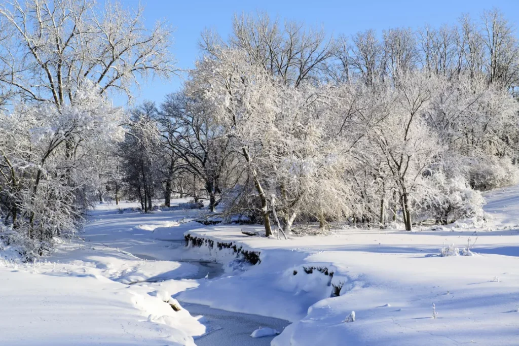
Houston is known for its humid subtropical climate, characterized by hot summers and mild winters. Snowfall is an infrequent event in the region. Since 1895, Houston has recorded snowfall approximately 39 times, averaging about once every three years. However, the accumulation is typically light, often melting upon contact with the ground. Significant snow events are rare, with notable occurrences including:
- February 14–15, 1895: Houston’s largest snowfall on record, with 20 inches of snow.
- February 12, 1960: 4.4 inches of snow.
- January 11, 1973: 2.0 inches of snow.
- December 22, 1989: 1.7 inches of snow, accompanied by a record low temperature of 7°F on December 23.
- December 10, 2008: Early snowfall tying the earliest accumulating snowfall record.
- December 4, 2009: Broke the earliest accumulating snowfall record.
- December 7, 2017: 0.7 inches of snow.
- February 15, 2021: Significant winter storm impacting the region.
These events underscore the rarity of substantial snowfall in Houston, making the January 2025 snowstorm particularly noteworthy.
The January 2025 Snowstorm: A Closer Look
The January 20–21, 2025 Gulf Coast blizzard was an exceptionally rare and historic winter storm that impacted the Gulf Coast of the United States, including Houston. This event marked the first recorded blizzard to ever affect the Gulf Coast region. In Houston, freezing rain and snow began on the evening of January 20 and continued into January 21, with up to 3 inches of snow reported near Liberty. The storm led to significant disruptions, including the suspension of flight operations at Houston’s major airports and numerous road closures due to snow and ice accumulation. State agencies mobilized resources in advance of the winter weather, and crews began pre-treating roadways ahead of the storm. The Electric Reliability Council of Texas (ERCOT) made preparations to avoid a situation similar to the 2021 crisis. Despite these efforts, the storm caused multiple fatalities in southwestern Texas due to a multi-car pileup.
Impacts on Daily Life and Infrastructure
The unexpected snowfall had widespread effects on Houston’s infrastructure and daily life:
- Transportation: Major roadways became hazardous due to ice and snow accumulation, leading to numerous accidents and prompting officials to advise residents to avoid travel. Public transportation services faced delays and cancellations.
- Air Travel: Both George Bush Intercontinental Airport and William P. Hobby Airport suspended operations, resulting in the cancellation of numerous flights and stranding travelers.
- Education: Schools and universities closed campuses, shifting to remote learning or canceling classes altogether.
- Utilities: The increased demand for heating and weather-related damages led to power outages in various parts of the city. Residents were urged to conserve energy and report any issues promptly.
Community Response and Resilience Snowfall in Houston:
Community Support: Neighbors assisted each other with snow removal, shared resources, and provided support to those in need.
Emergency Services: First responders worked tirelessly to address emergencies, clear roads, and ensure public safety.
Local Businesses: Many businesses adapted by offering remote services or adjusting hours to accommodate both employees and customers safely.

Despite the challenges, Houstonians demonstrated resilience and adaptability:
- Community Support: Neighbors assisted each other with snow removal, shared resources, and provided support to those in need.
- Emergency Services: First responders worked tirelessly to address emergencies, clear roads, and ensure public safety.
- Local Businesses: Many businesses adapted by offering remote services or adjusting hours to accommodate both employees and customers safely.
Preparing for Future Winter Weather Events Snowfall in Houston:
The January 2025 snowstorm serves as a reminder of the importance of preparedness, even for rare events:
- Infrastructure Investment: Investing in infrastructure that can withstand unusual weather patterns is crucial. This includes enhancing the resilience of power grids and transportation networks.
- Public Awareness: Educating residents about emergency preparedness, including maintaining supplies and understanding safety protocols, can mitigate the impact of such events.
- Policy Development: City planners and policymakers should consider the potential for atypical weather events in future urban development and emergency response strategies.
The rare snowfall in Houston on January 21, 2025, was a historic event that tested the city’s infrastructure and the resilience of its residents. While such weather phenomena are uncommon, this experience underscores the importance of preparedness and community solidarity in the face of unexpected challenges.
Winter Storm Watch: Snow, Ice, and Hazardous Conditions Across the Gulf Coast
As winter tightens its grip on the Gulf Coast region, a significant weather event is set to bring snow, ice, and gusty winds from Tuesday into early Wednesday. This rare winter storm is expected to create hazardous conditions, with significant impacts on travel and infrastructure across southern Louisiana, southern Mississippi, southern Alabama, Georgia, and the coastal Carolinas.
Tuesday-Tuesday Night Forecast
The Gulf Coast, typically associated with milder winters, will face a formidable mix of snow, ice, and strong winds starting Tuesday. The weather will intensify from west to east throughout the day, with gusts exceeding 30 mph along the immediate coastline. These gusty winds will not only exacerbate the chill but will also create near-blizzard conditions in some areas, reducing visibility and making travel dangerous.
As the day transitions into night, most of the wintry weather west of the Mississippi River will taper off. However, parts of Georgia, northern Florida, and the Carolinas will continue to experience snow and ice into early Wednesday morning. By Wednesday afternoon, the storm is expected to dissipate, leaving hazardous road conditions in its wake.
Key Impacts by Region
- Louisiana and Southeast Texas:
- Snow accumulations of up to six inches are possible in southern Louisiana, particularly in areas experiencing heavier snow bands.
- Lake Charles, Louisiana, could record one of its top five snowstorms, with totals exceeding three inches. The city’s all-time record of 22 inches from February 1895 remains safe, but this storm could approach the second-place record of five inches.
- Mississippi and Alabama:Snowfall in Houston:
- Southern Mississippi and southern Alabama will see several inches of snow, with some areas receiving up to a half-foot. Strong winds will contribute to blowing snow, creating treacherous travel conditions.
- Georgia and the Carolinas:
- Snowfall totals across Georgia and the Carolinas will vary widely, ranging from a dusting to six inches. The greatest accumulations are expected in central and southern Georgia and the coastal Carolinas.
- In Atlanta and areas along Interstate 20, the northern extent of the snowfall remains uncertain. Even light snow or ice could create significant travel disruptions.
- Northern Florida and Southeast Georgia:
- Northern Florida and southeast Georgia may see enough ice accumulation to damage trees and power lines, potentially causing power outages. Ice accretions of up to a quarter-inch are possible in some areas.
Snowfall Records at Risk
This storm has the potential to rewrite parts of the Gulf Coast’s winter weather history:
- Florida’s 24-hour snowfall record of four inches could be in jeopardy if heavier snow bands persist.
- Snowfall totals in parts of southeast Texas and southern Louisiana may approach historical highs, with significant implications for local communities unaccustomed to such conditions.
Estimated Snowfall So Far
As of late Tuesday morning, snow had already blanketed parts of southeast Texas and Louisiana:
- Houston metro area: Up to four inches of snow.
- Galveston, Texas: Light flurries were reported, an unusual sight for the region.
- Brownsville, Texas: Snowfall was observed early Tuesday, accompanied by gusts of up to 44 mph. This marks one of the southernmost snow events in the United States this season.
In south Texas, ice accumulation earlier Tuesday reached up to a quarter inch, causing scattered power outages and hazardous travel conditions.
Meteorological Setup
The current weather pattern responsible for this rare Gulf Coast winter storm is a classic setup seen during late January and early February:
- Arctic Air Mass: A widespread surge of arctic air has plunged deep into the southern United States, providing the cold temperatures necessary for snow and ice to develop.
- Gulf of Mexico Moisture: A weak wave of low pressure over the Gulf of Mexico is pulling moist air northward, where it interacts with the frigid air to produce wintry precipitation.
This combination of cold air and Gulf moisture is a hallmark of Southern winter storms. While these storms are infrequent, they can bring significant impacts when they occur, particularly in areas unaccustomed to dealing with snow and ice.
Travel and Safety Tips
With hazardous conditions expected across the region, residents are urged to take precautions:
- Avoid non-essential travel, especially in areas forecast to receive snow or ice. Roads may become impassable due to slick conditions and poor visibility.
- If you must travel, ensure your vehicle is equipped with an emergency kit, including blankets, water, food, and a fully charged phone.
- Prepare for potential power outages by stocking up on essential supplies such as batteries, flashlights, and non-perishable food.
- Stay informed by monitoring local weather updates and following guidance from local authorities.
Looking Ahead
By early Wednesday, the storm will have largely exited the Gulf Coast region, but its impacts will linger. Hazardous road conditions, downed power lines, and lingering cold temperatures will continue to affect daily life. Additionally, as temperatures rise later in the week, melting snow and ice could lead to localized flooding in low-lying areas.
Conclusion
This rare winter storm serves as a reminder of the unpredictability of weather, even in regions typically associated with milder climates. Residents across the Gulf Coast are encouraged to stay vigilant, prioritize safety, and remain prepared for the storm’s impacts. While the storm will soon pass, its effects will be felt for days to come. visit THENEWSIFY for more news


Leave a Reply